< Back to News
Ocean Hackathon® 2023 - Kuala Lumpur
Fri, 17 November 2023 16:00 - Sun, 19 November 2023 16:00
Details of the event
Ocean Hackathon Kuala Lumpur is organized by the Embassy of France to Malaysia, as part of its ongoing efforts towards environmental awareness and ocean preservation. For this second edition, we have gathered 12 amazing challenges and teamed up with the French School of Kuala Lumpur to make this an unforgettable experience.
With the help of your teammates and the support of an outsdanding team of mentors from the finest Malaysian and French institutions, you will goway beyond what you thought you could achieve, learn plenty of new skills - and have loads of fun in the process. Register now!
Warning SPAM registration:
When you register, a confirmation email will be sent to you in order to proceed with the payment. This confirmation email may arrive in your Spam or Junk mail.
Contact:
Valérie Barbosa : [email protected]
REGISTER NOW
La Nuit des Idées 2023
21 Oct 2023, 4:00pm - 9:30pm (GMT+08:00) Kuala Lumpur
Oceans: Could less mean more?
Second edition of la Nuit des Idées (the Night of Ideas) in Malaysia!
Did you know that oceans cover more than 70% of the planet's surface? That marine and coastal ecosystems provide food for billions of people around the world? Or that oceans also play a major role as climate regulators? And yet, despite their relevance, our oceans are increasingly threatened by pollution, overfishing, climate change, tourism, etc. Plastic pollution, for instance, is expected to triple by 2040. So how can we do more to protect our oceans? What if doing more meant doing less (waste, pollution), doing better (decision-making), doing it together (collaborating)?
Come explore this concept during our “Nuit des Idées 2023” hosted by Alliance Française of Kuala Lumpur. Through various activities, we will reflect on how a shift in perspective can lead us to making better choices for our oceans and ourselves. You will also be able to enjoy a vibrant art installation by Hara Makers and contribute to our Wall for the Oceans and commit to adopting one eco-friendly gesture. Check out our exciting programme – and register ASAP!
Credit:
https://www.alliancefrancaise.org.my/community/event-rsvp/?event_id=262
KUL01 - Tracking Coral’s Health and Spawning

Tropical coral reefs are the main habitat providing important ecological services to human being – and hard coral is a crucial component of these reefs. Unfortunately, coral reefs are threatened by numerous anthropogenic factors that cause significant environmental change and may increase the rate of coral reef degradation. It is therefore to better monitor their health status and to improve our knowledge and understanding of their reproductive processes. Currently, information about coral spawning in Malaysia (and South East Asia) is scarce and segmented, due to the fact that spawning events occur only in specific nights of the year, under very particular conditions (related to tidal cycle, sun and moon phases, seawater temperature and light intensity) and can be as short as few minutes. The developed app will allow for passionate members of the diving community to strongly contribute into collecting extremely valuable information and recordings, ultimately increasing the effectiveness of conservation efforts (especially in the case of endangered coral species) and of Marine Protected Areas (MPAs) management (e.g.: limit access to identified areas during spawning time to reduce human disturbances). Local communities and multiple stakeholders may also be involved in this initiative.
What the challenge owner would like to develop over 48h
Create a website database with mobile apps
Which skills the challenge owner is looking for
IT developer, Software Engineer, AI specialist, Oceanographer, Ecologist, Citizen science specialist, Graphic designer, Marketing specialist
KUL02 - Digital Marine Fish Stocks: Distributed System for Monitoring Overfishing and Underfishing in Ocean
Overfishing in the ocean is a very specific problem depending on place and time, implying any overfishing and the loss of its marine biodiversity as well as threats to particular fish species. For example, the Chinese paddlefish became extinct due to overfishing. Overfishing in the ocean in the past has led to the decline of some fish species (fish-decreasing), which has had a negative impact on the marine ecosystem. Underfishing is critical to preserving marine biodiversity. We have studied that a real-time-based digital application is needed for monitoring fish-decreasing as well as overfishing and underfishing of marine fish which we feel is lacking. In order to protect the marine fish diversity and properly maintain the fish-based economy of coastal people, it is necessary to have real-time Fish-Stocks software through which Overfishing and Underfishing can be monitored at different times in different areas, which is currently a big challenge. Based on this challenge, we proposed the "Digital Marine Fish Stock" model where the data of fish caught by fishermen in different areas is stored in a central cloud server database by accessing software applications set in different areas, and a central monitoring team can monitor monthly or weekly overfishing and underfishing through the software. It is possible to get an immediate warning of overfishing for specific fish by setting the formula at the computer programming level of the proposed model.
What the challenge owner would like to develop over 48h
Create a desktop based application
Which skills the challenge owner is looking for
IT developer (Java, MySQL), app developer, data scientist, data visualization specialist, distributed systems expert, marine fisheries expert, natural traveller
KUL03 - Spatial and Temporal Visualization for Enhancing Climate Change Monitoring and Flood Management
This challenge is focused on building an interactive database as foundation for developing rainfall design characteristics for a water catchment as well as to study the rainfall runoff relationship using machine learning. Prevalence of flood has often been anecdotally associated to climate change due to the fragmentary hydrological data set and limited hydrological data analysis to validate the claim. To date, the rainfall runoff relationship in a water catchment is still not well understood for managing flood effectively due to the lack of coordination in establishing both rainfall and water level monitoring stations. The existing information system showing these data can be further enhanced in terms of legibility to better inform lay people especially those in the decision-making group. With the application of IOT systems to provide real-time monitoring, it is a matter of analyzing the data and providing spatial and temporal visualization to facilitate informed decision making and planning for developing urban drainage system to mitigate flood effectively. This challenge involves some basic temporal data analysis using existing data sets, and develop real time spatial visualization and indication of rainfall or high/low water level. Besides temporal data analysis, there is a need to analyze the characteristics of individual rainfall events such as intensity, duration and frequency which is essential for studying the rainfall pattern and its influence on the runoff at the water level monitoring stations.
What the challenge owner would like to develop over 48h
Create an interactive database/information system, mobile app
Which skills the challenge owner is looking for
Data analyst, IT developer, GIS, dashboard, scientist (hydrology, oceanology), communication specialist, graphic designer
KUL04 - SeaSleuths: Exploring Marine Biodiversity with Interactive Citizen Science
Organisation
THE SOUTH CHINA SEA REPOSITORY AND REFERENCE CENTRE, UNIVERSITI MALAYSIA TERENGGANU
Melissa Beata MARTIN
Site webMalaysia is a vital hub for marine biodiversity, but most citizens remain unaware of its richness and the need for conservation. The South China Sea Repository and Reference Centre (RRC) holds over 50,000 aquatic specimens, yet its treasures remain hidden from the public. SeaSleuths emerges as a transformative force with a threefold vision. Firstly, it aims to make RRC's specimen data universally accessible through an interactive inventory or picture gallery search, enlightening the public about Malaysian marine life. Secondly, SeaSleuths presents species biodata through captivating infographics, shedding light on topics like invasive species, pollution, and climate change. Educational resources and real-time updates from research initiatives will foster an informed community dedicated to marine conservation. Thirdly, SeaSleuths creates an interactive citizen science platform where citizens actively contribute their sampling data and photographs. Expert verify species, and advanced AI aids species comparison, enhancing accuracy and efficiency. An interactive map allows users to explore species distribution in Malaysia and adjacent waters, deepening their understanding of the interconnected web of marine life. Gamification elements inspire engagement, rewarding participants with badges and achievements, fostering a passionate community committed to preserving Malaysian marine biodiversity. In summary, SeaSleuths unlocks Malaysia's marine diversity potential, inviting every citizen on a transformative journey towards ocean literacy, conservation, and ensuring future generations inherit a thriving and sustainable marine ecosystem.
What the challenge owner would like to develop over 48h
The development of a fully operational SeaSleuths platform would ensure a comprehensive and web application, which would include the following features:
1. Data Accessibility (Objective 1): Data scientists and developers would work on building a robust database that houses the RRC's specimen collection data. They would implement efficient algorithms for data retrieval and ensure real-time updates are available to users.
2. Infographics and Educational Resources (Objective 2): Content creators, marine biologists, and graphic designers would collaborate to develop engaging infographics and concise species biodata. They would also curate hyperlinks to educational resources on topics like invasive species, pollution, climate change, and marine conservation.
3. User Interface and Experience (UI/UX) (Objectives 1 and 3): Designers and developers would collaborate to create an intuitive and visually appealing interface. The platform should be easy to navigate, with a seamless search function for the specimen inventory and interactive map.
4. Citizen Science Integration (Objective 3): Developers and data scientists would create an interactive citizen science platform where participants can contribute their sampling data and photographs. They would develop systems to verify species and integrate AI features for species comparison.
5. Gamification Elements (Objective 3): Gamification experts would implement badges, achievements, and rewards to incentivize user engagement. They would design challenges and tasks that encourage participants to explore, learn, and actively participate in marine conservation efforts.
6. Outreach and Marketing (All): Marketing specialists would devise strategies to promote SeaSleuths, reaching out to the public, schools, and environmental organizations to generate awareness and encourage participation.
7. Testing and Quality Assurance (All): Quality assurance testers would continuously evaluate the platform's functionality and user experience, identifying and rectifying any issues or bugs.
8. Security and Privacy (All): IT experts would ensure the platform's security, protecting user data and preventing any potential breaches.
Which skills the challenge owner is looking for
AI/ML, data scientist, web developer, UI/UX Designers, taxonomist/marine specimen curator, marine biologist, ecologist, environmental educator, conservationist, GIS expert, content and communication specialist, graphic designer, gamification specialist, marketing specialist
KUL05 - Watch out! An app to look after marine biodiversity, together
The Kunming-Montreal Global Biodiversity Framework (GBF) adopted by COP 15 represents the most ambitious global agreement on biodiversity in the history of environmental governance. It will serve as the world's framework for actions taken at all levels to safeguard and restore biodiversity under 23 targets to be achieved by 2030 and towards four long-term goals for 2050. One of GBF Target 3 indicators: “Coverage of protected areas and OECMs” recommends that areas high in species richness or threatened species, and threatened habitats (such as the Coral Triangle) should be prioritized in reaching this target. These areas should: be ecologically representative, address connectivity, be part of networks of protected areas and have appropriate governing systems. According to IUCN, implementation in the Coral Triangle (CT) region will lead to achieving 30% of the global target by 2030, with the highest level of marine biodiversity protection. Some of the threatened species identified by the CT Initiative are marine turtles, sharks and rays, and marine mammals; connectivity of habitats for migratory species is a crucial factor for MPA design. Therefore, to assist the CT region and raise awareness among the general public and decision makers, our objective is to create an interactive, user-friendly and AI-powered app/website for citizen science monitoring, including data visualizations (eg. interactive maps) and dashboards of GBF Target 3 elements.
What the challenge owner would like to develop over 48h
Create an interactive app/website that is user-friendly for Citizens Science Monitoring, and preferably powered by AI, to produce visualizations (including interactive maps) and dashboards of GBF Target 3 elements required.
INPUTS/DATA NEEDED:
IFREMER/France to provide Data from various international, regional etc databases (e.g. Allen Coral Database, UNEP WCMC, etc), including tracking data, GIS data, and satellite data that, for a start, can produce the following:
•Map and quantification (coverage) of critical marine habitats (latest information) e.g. seagrass, coral reefs (to visualize the extent of these habitats)
•Map and quantification (coverage) of marine areas above already under protection, and which areas not yet protected (to visualize which needs protection, and for better networks of protected areas and connectivity, so as to achieve Target 3)
•Map of hotspots and migratory paths of specific marine ETPs (endangered, threatened and protected) migratory species e.g. marine mammals (dugong, cetaceans), turtles, whale sharks, manta rays (to visualize which areas of these ETPs hotspots and migratory paths are already protected, and which areas are not but should be protected, to form networks of connected areas for these ETP flagship migratory species)
•Map of live high Sea Surface Temperature (SST) to act as Alert/Warning/monitoring system (to visualize potential bleaching events areas, and to identify priority areas to increase ecosystem and community resilience, etc.)
These maps can be layered for integrated information.
Which skills the challenge owner is looking for
Data analyst, IT developer, oceanographer, ecologist, geomatic expert, marine biologist, graphic designer, data visualization specialist
KUL06 - Accessible Ecotourism backed with scientific evidence and policy
Individual
Afiq DURRANI
I would like to create an environment where the community or consumers have access to ethical practices in tourism. This means tourism operators that abide to best practice determined by scientific evidence are rewarded and promoted in a system that is globally accessible. Think of it like an Airbnb but curated for verified and approved ecotourism services (boat operators, snorkeling guides, diving shops, and hiking or trailing guides). Tourism operators may seek help from scientific community as well as inform the community on difficulties they face within their locality. Policy makers will be involved in providing support for the growth and sustainability of these operators based on community feedback and scientist recommendations.
What the challenge owner would like to develop over 48h
Create a mobile and web based app
Which skills the challenge owner is looking for
App developer, marine biologist, ecologist, socio-economist, eco-tourism specialist, legal expert, communication specialist
KUL07 - Advancing Detection Efforts: Safeguarding Ecosystems from Invasive Species
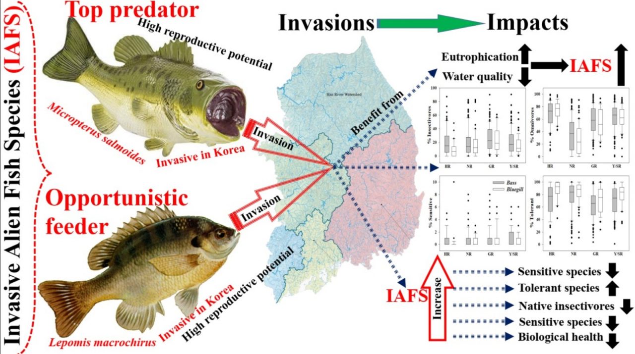
Invasive species pose a significant threat to ecosystems worldwide, causing ecological disruptions, economic losses, and the decline of native biodiversity. Early detection plays a vital role in mitigating these impacts by enabling prompt and targeted management strategies. Detection methods range from traditional field surveys (sometimes including citizen science) to advanced technological approaches. Automated systems, utilizing sensors and data loggers, can continuously monitor various environmental parameters such as water quality, temperature, and nutrient levels. Deviations from baseline conditions can indicate the presence of invasive species and trigger early detection protocols. Environmental DNA (eDNA) analysis, acoustic monitoring and remote sensing technologies, such as satellite imagery, can also make crucial contributions to invasive species detection.
Machine learning and artificial intelligence algorithms have shown promise in data analysis and highly accurate recognition of invasive species, thus aiding in real-time detection and identification. Equipped with cameras, sensors, and artificial intelligence, these robotic platforms can survey large areas, collect data, and identify invasive species in a cost-effective and timely manner.
By identifying the degree of risk posed by an invasive species, scientists and policymakers can prioritize resources for invasive species management and allocate efforts to areas where they are most needed. Early detection also enables public awareness and engagement, fostering community participation in invasive species monitoring and prevention. By harnessing the power of technology and promoting awareness and engagement, we can strengthen invasive species detection efforts and protect our fragile ecosystems from the harmful effects of invasive species.
What the challenge owner would like to develop over 48h
Create a UI/UX
Which skills the challenge owner is looking for
Software engineering and hardware engineer, App developer, oceanographer, specialist in invasive species
KUL08 - A creative advertising billboard for raising public awareness and promoting donations
Individual
Peggy Pei Yee TEK
My challenge is establishing the software necessary to develop a creative digital street billboard to engage the donation, fostering the impact environmental crisis and promoting the field event (Example: https://www.youtube.com/watch?v=zVuWtWZh4oQ). The content of the billboards will be updated monthly using ocean-related digital data on various topics. After establishing this billboard, I would like to develop collaborations with environmental NGOs in Malaysia, who could reach wider audiences by using this billboard to promote their field events (beach cleaning, mangrove planting workshops). Additional donation features will generate the necessary income to cover maintenance costs – any extra revenue could be donated to the partner NGOs. NGOs rely heavily on financial support from individuals, corporations, and even government grants to carry out activities such as conservation efforts, awareness campaigns, research, and advocacy. This project will contribute to help them pursue their vital work in protecting and preserving the environment in Malaysia.
What the challenge owner would like to develop over 48h
Create an attractive digital advertising billboard to raise public awareness related to marine environment crisis, while promoting donations
Which skills the challenge owner is looking for
Marine biologist, focusing on environmental restoration, oceanographer, software developer, IT specialist, business specialist, communication specialist, education specialist.
KUL09 - Advancing Management of Harmful Algal Blooms: A High-Performance Predictive Tool for Enhanced Prevention and Mitigation
A “red tide” is a common term used for a harmful algal bloom (HAB). A HAB occurs when colonies of algae accumulate in high concentrations, or form "blooms". These particular species can cause harm due to their ability to produce potent toxins, or through impacts associated with their sheer biomass (oxygen depletion, light blockage, habitat alteration). Only a few dozen species of microscopic and macroscopic algae are repeatedly associated with toxic or harmful blooms.
Can we create an algorithm to predict these blooms? Yes, the algorithm can provide valuable insights and probabilistic forecasts based on historical data, environmental conditions, and biological factors.
Can we incorporate this algorithm and an app? An app can be developed to gather and provide information about red algae blooms and assist marine biologists, ocean fieldworkers, and leisure consumers. Such an app could be a valuable data collection, bloom tracking, species identification, data analysis and visualization, and communication tool. By better understanding and predicting these phenomena, some species associated with HABs could offer renewable and eco-friendly alternatives to traditional resources.
What the challenge owner would like to develop over 48h
Create a mobile phone and an algorithm on which the prediction analysis runs.
Which skills the challenge owner is looking for
IT developers, App/web developer, phycologists/HABs specialists, Oceanographers, Marine biologists, Data scientists, Actuarial scientists, Communication specialists, Graphic designers
KUL10 - Drone analysis of mangrove species and basic health condition
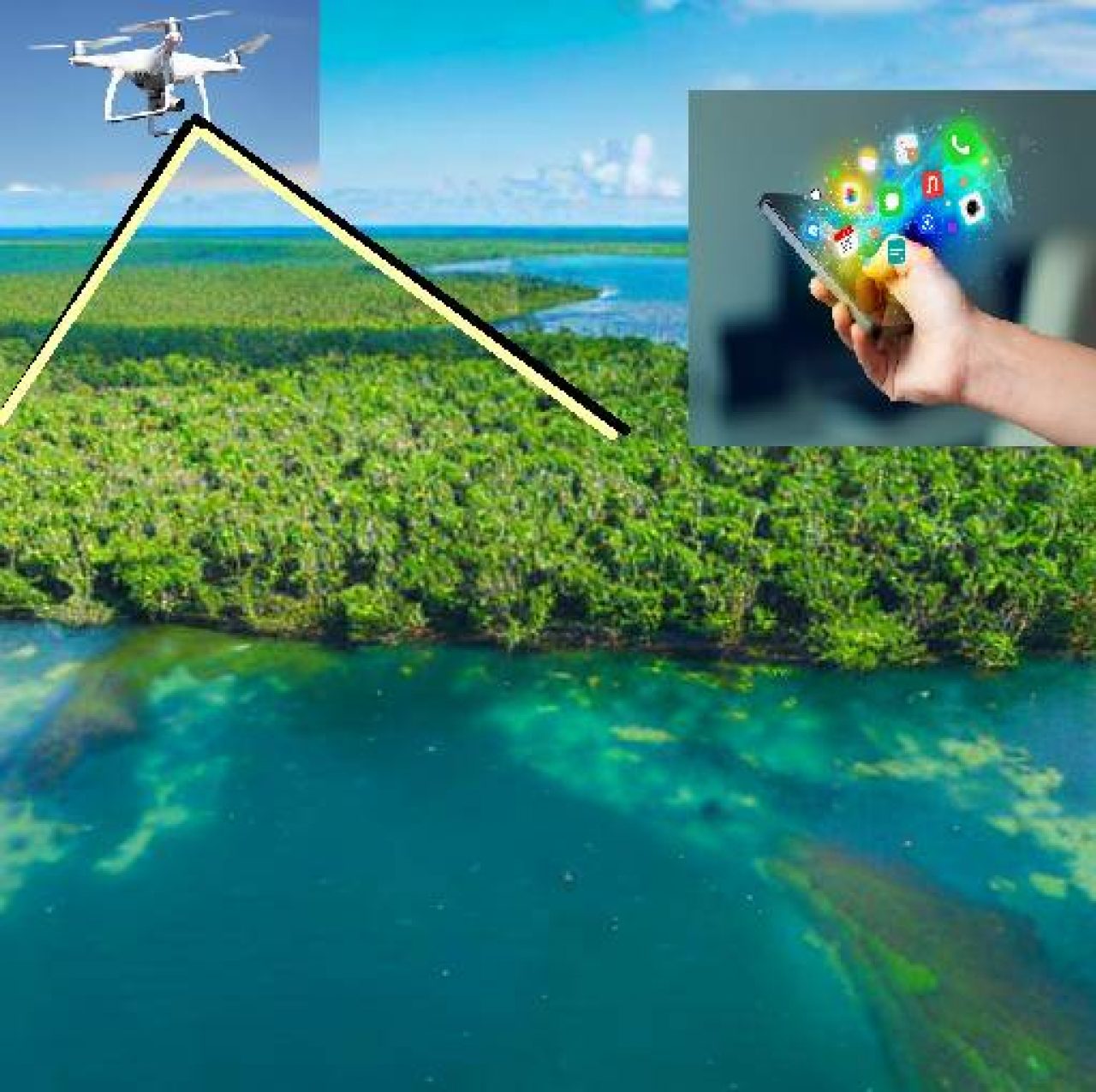
Individual
Jiayong LAI
We invite participants to develop an innovative mobile application that utilizes drone footage to identify mangrove tree species and assess their basic health condition. Mangrove ecosystems play a crucial role in coastal protection, biodiversity conservation, and climate change mitigation. However, monitoring and understanding the health of these ecosystems can be challenging and time-consuming. The proposed DroneApp should leverage machine learning and computer vision algorithms to analyze drone-captured footage of mangrove areas and provide valuable insights. Key features of the application may include: Species Identification: Utilize image recognition techniques to identify different mangrove tree species accurately. Health Assessment: Develop algorithms to assess the basic health condition of identified mangrove trees, considering factors such as leaf color, density, and overall vitality. Data Visualization: Present the results in an intuitive and user-friendly interface, displaying identified species, health assessments, and any potential threats or anomalies detected. Geolocation Integration: Incorporate geolocation data to map the identified species and health assessments, providing a comprehensive view of mangrove ecosystems.
What the challenge owner would like to develop over 48h
Create an mobile app which is able to give information about mangrove condition and basic species to help surveyor identify and determine harsh mangrove terrain
Which skills the challenge owner is looking for
IT developer, on ground mangrove expert for species and basic indexes, citizen science specialist, communication expert
KUL11 -" Gotta Catch 'Em All!": Capturing commercial crab landing, biodiversity, and conservation data in peninsular Malaysia via a citizen-based game model
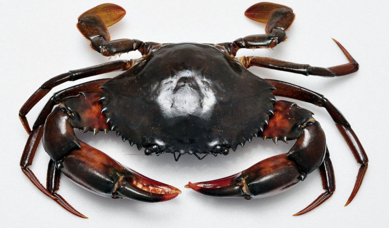
Crab fishery is an important economic activity that supports the livelihood of coastal communities in Malaysia. There are several commercially important crab species that are highly sought after, both in the national and international markets, including mud crabs and blue swimming crabs. However, data on the types of species, their landings, sizes, and locations are almost non-existence, and this hampers the fishery management and conservation efforts of commercial crabs in peninsular Malaysia. As we believe in the inclusion of all levels of society into safeguarding our natural resources, and with the current technology readiness of all members of the society – from kids to older adults, the challenge will be to develop an interactive game that would allow users to report the findings of the edible crabs they bought or found in the wet markets, along with essential data that would contribute to the conservation and future fishery management of these valuable natural resources in Malaysian waters. The availability of these data can be used to estimate size at maturity, seasonal abundance, and ultimately inform policy for the establishment of fishery management measures such as the establishment of minimum landing size for commercial crab species in Malaysia.
What the challenge owner would like to develop over 48h
Create a game
Which skills the challenge owner is looking for
IT developer, marine biologist, data analyst, graphic designer, game developer, specialist in citizen science
KUL12 - What Changed in Malaysian Waters? Development of basic application programming interface (API) with Real time collection and representation of open-sourced remote sensing data
Climate change has been threatening our livelihood and longevity of human civilization. Thus, the public should be aware of the empirical data and situation of climate change, so as to react and adapt to the situation. However, most data evidence of climate change in both governance and public awareness are hard to access or understand by the public. Furthermore, it takes large, long, and robust database to represent comprehensively the effects of climate change, due to its subtle and slow effect on us. Nevertheless, with the development of easy access, real-time collection, and open-sourced data on our environment, such data could never had been easier to access. With that said, such large data require a mammoth effort to organize, analyse and represent it in a publicly acceptable way. To date, such accessibility, both in publicly availability and understandability, is still lacking, which limits the awareness of climate change (especially the ocean) in our public. Especially in Malaysia, where we are in the centre of the biodiversity hotspot, Coral Triangle, which is threaten by climate change. Such effort to collate and disseminate the data is much needed. Hence, we require an effort to automate the collection of such real-time data in open-source platform regularly and represent it in the context of Malaysia to raise the awareness. The main objective of the project is to let the participants create a simple website which can help in educating the masses on climate change in developing countries (such as Malaysia). Temperature has been the dominant measurement of climate change. However, there are also a few indicator parameters which can be mined from satellite images. They are Sea Surface Temperature, Chlorophyll a, Salinity, rain cloud formation and more. The output of the challenge will see a development of common application programming interface (API) that can help in streamlining and optimizing the process. The participants will have to generate an API based on data from established database (i.e. GES DISC database), and turn to interactive application: annual, decadal average, annual difference, decadal difference), At the end of the session, participants will generate a simple interactive software, which can be used for public education and awareness program on climate change.
What the challenge owner would like to develop over 48h
Create an API that can be applied to any website which are interested in representing climate change data of Malaysia (and perhaps the other parts of the world if opportunity given)
Which skills the challenge owner is looking for
Python, R, SQL, Marine Science, Modeler, Marine Biologist, Social Conservationist, Web developer, Graphist, Communication specialist